
In which we explore the strange paths taken by national borders around the world. Also, doughnuts. Mmmm, doughnuts…
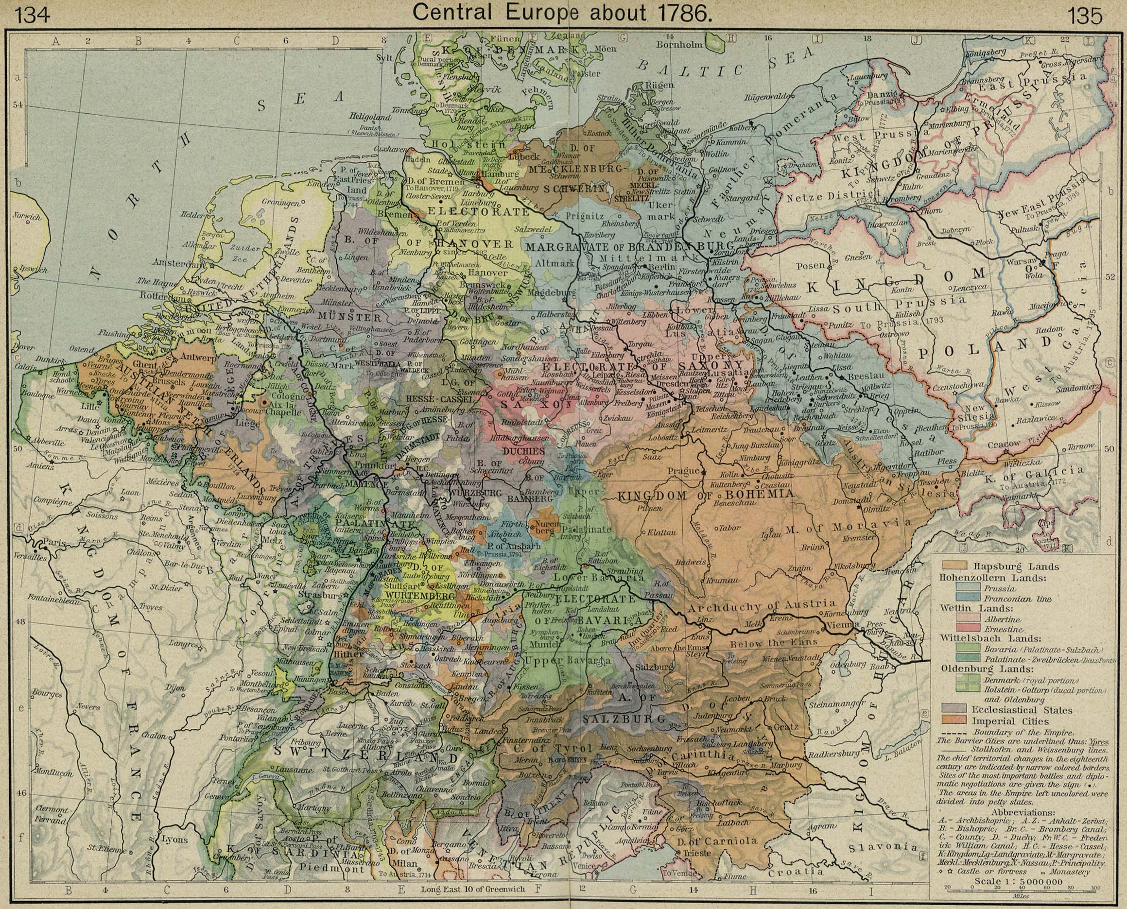
Most national borders that exist today are the result of many decades (or even centuries) of redrawing, and these redrawings were often entangled with the wars, treaties, or imperial ambitions of the time. Sometimes, the border is the result of a very clear principle—for example, the US-Canada border runs neatly along the 49th parallel for much of its length (though this article shows how it’s not quite that simple). Other times, it’s the result of a long an torturous process—compare this map of the Holy Roman Empire in 1786 with the simpler subdivisions of the modern state of Germany. [Side note: all maps from this point onward are taken from Google Maps.]
In this post, I’ll share some examples of unusual national borders—just to get the lay of the land. In the next post, I’ll examine some of the most complicated examples, and begin to apply a mathematical concept (the fundamental group) that, hopefully, will clarify the messy business of national borders.
Before going any further, though, some terminology is in order.
Enclave: an enclave is any portion of a state/province/country that is completely surrounded by another state/province/country. One good example of an enclave is the entire nation of Lesotho, which is “enclaved” within South Africa.
Exclave: an exclave is a portion of a state/province/country that is separated from the main part by multiple states/provinces/countries. A good example of this is the Kentucky Bend, a portion of the US state of Kentucky that is surrounded by Missouri and Tennessee.
An interesting side note: the western borders of Kentucky and Tennessee are defined by the Mississippi River, following the course it ran when originally the border was originally defined. Over the years, most rivers will change their course in multiple places, which means that many states have small chunks that lie on the opposite side of the Mississippi River (go explore the above map to see what I mean). These are called pene-exclaves, since the border doesn’t separate them from their state, but rather a geographic feature (in this case, the river).
Warning! These definitions are not mutually exclusive. Some, but not all, exclaves are also enclaves. To avoid confusion, I’ll just say exclave to mean one portion of a country that’s separated from the main part, and enclave to mean a country that’s completely surrounded by a single other country.
Another Warning! These definitions depend on which country you’re referring to. One example of this is the Spanish town of Llívia (see map below); it is enclaved within France, but it is an exclave of Spain.
Let’s see what else is out there! We continue our tour through Europe:
Enclaved Countries. There are a number of microstates in Europe, but only two of them are true enclaves: San Marino and Vatican City, both surrounded by the Italian Republic. These two, along with Lesotho, give us all of the world’s enclaved countries.
Alpine Villages. The Alps are host to two interesting exclaves, both surrounded by Switzerland. One is the Campione d’Italia; it’s surrounded by the southern Swiss canton of Ticino. The other is Büsingen am Hochrhein, a German town surrounded by Schaffhausen canton.
The Politics of Railroads. The Belgium/Germany border is host to a strange series of exclaves.
As you can see from the map, there are five German exclaves surrounded by Belgium (one of which is just a house & its yard), which are just barely separated from their homeland. There are two roads and a rail line running to the east of these exclaves, which are owned by Belgium. Apparently, the entire thread of territory was once a rail line (the Vennbahn) that Germany ceded to Belgium as part of the Treaty of Versailles. The roads intersect with German roads and highways, but are still Belgian. It’s really strange—go poke around the map.
Doughnuts. Lest we spend all of this post in Europe, the Arabian peninsula is host to a fascinating little enclave/exclave situation. The village of Nahwa strides the border of Oman and the United Arab Emirates (UAE), which itself isn’t all that unusual in itself. However, the UAE portion is part of an enclave, surrounded by Omani territory which is itself surrounded by UAE territory, thus creating a doughnut-shaped chunk of Oman inside of the UAE.
The innermost UAE territory is an example of a second-order exclave: an exclave within an exclave. This might seem to be the height of absurdity when it comes to national borders, but it turns out we’re only getting started. In my next post, we will hit the accelerator and see how complicated things can really get—including a look at the world’s only third-order exclave.
See ya next time!
